- Ružomberok
- Places to visit
- Nature
- Peaks and Vistas
- Peak Mních (Monk)
Peak Mních (Monk)
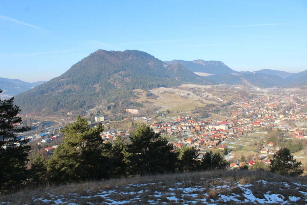
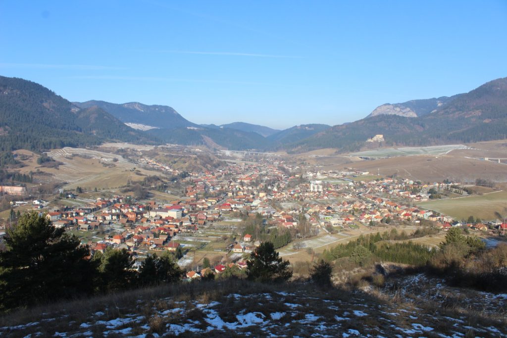
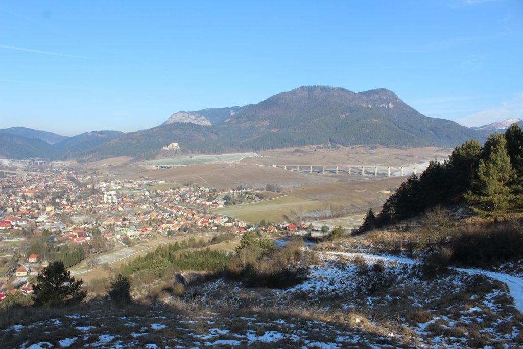
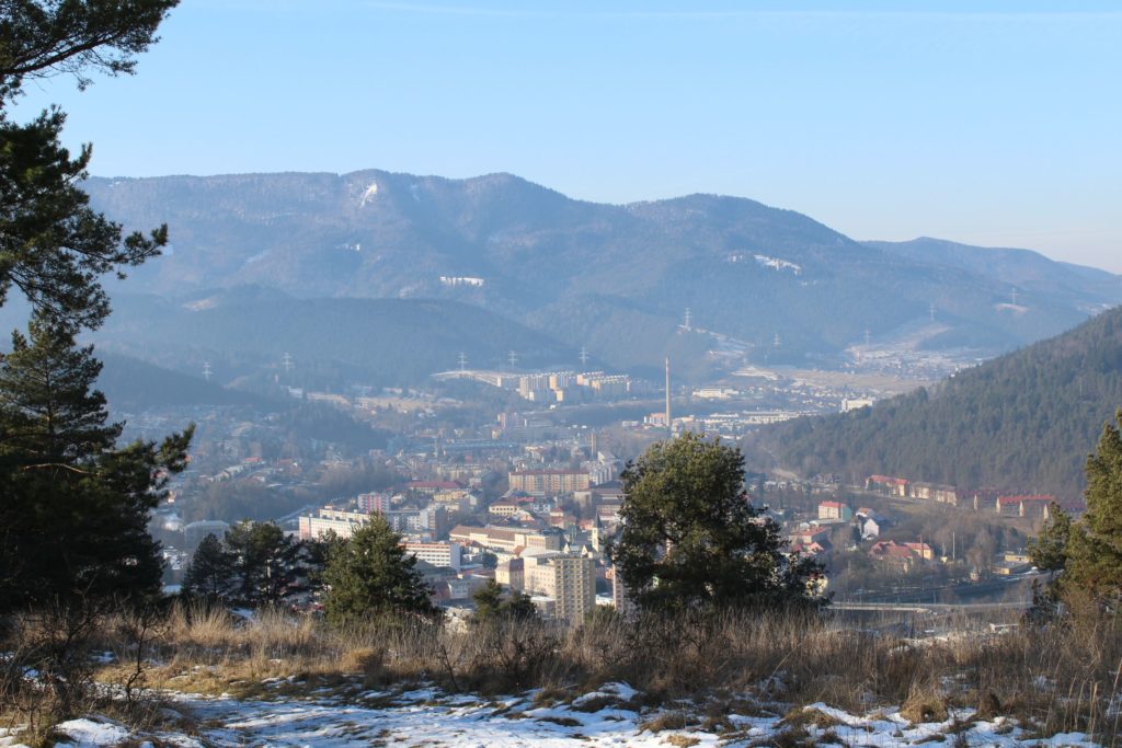
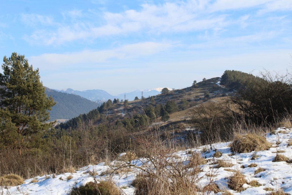
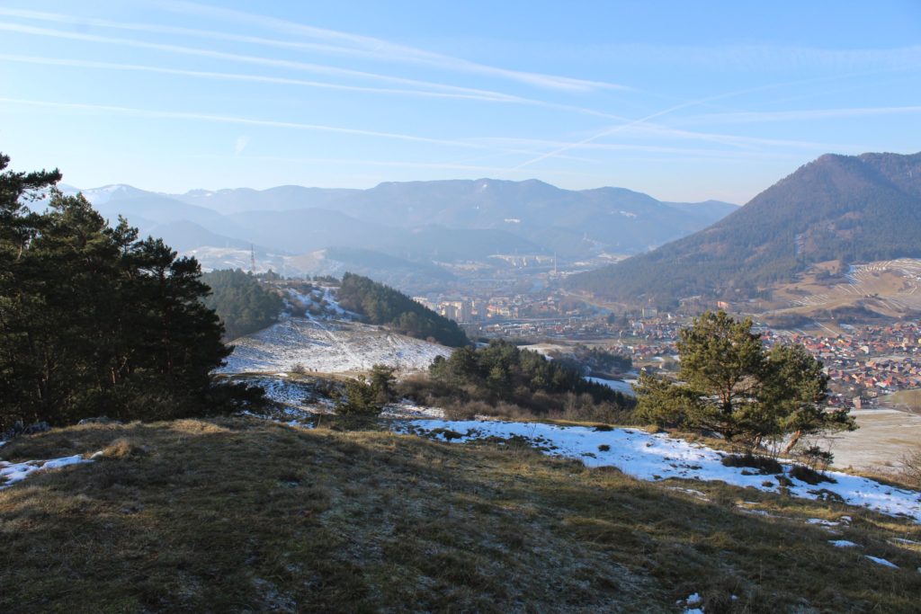
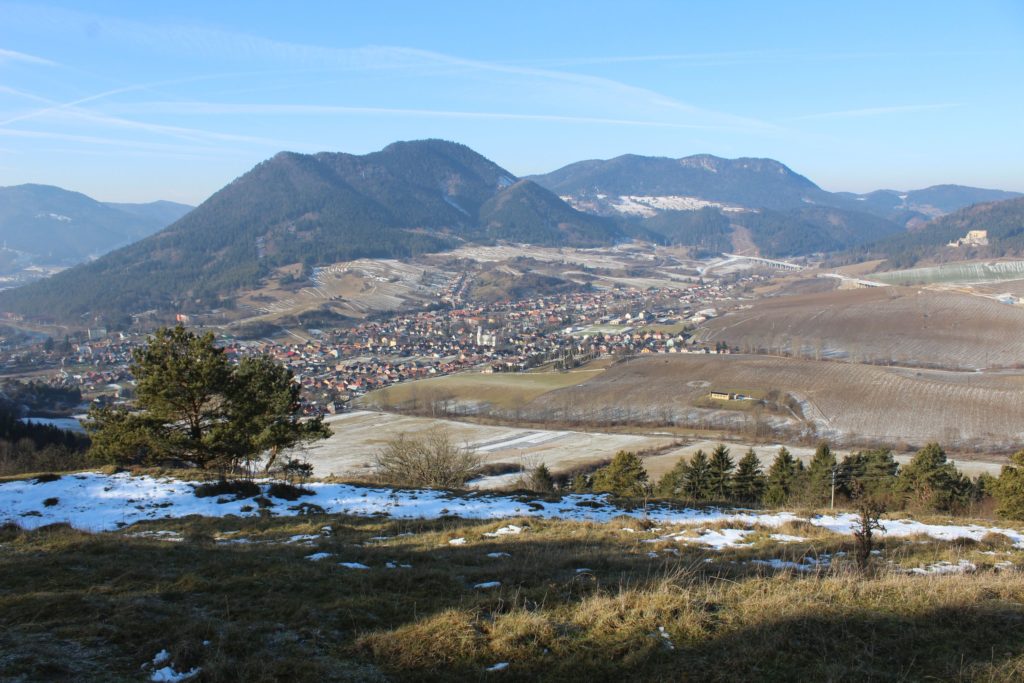
Peak Mních offers an easily accessible viewpoint.
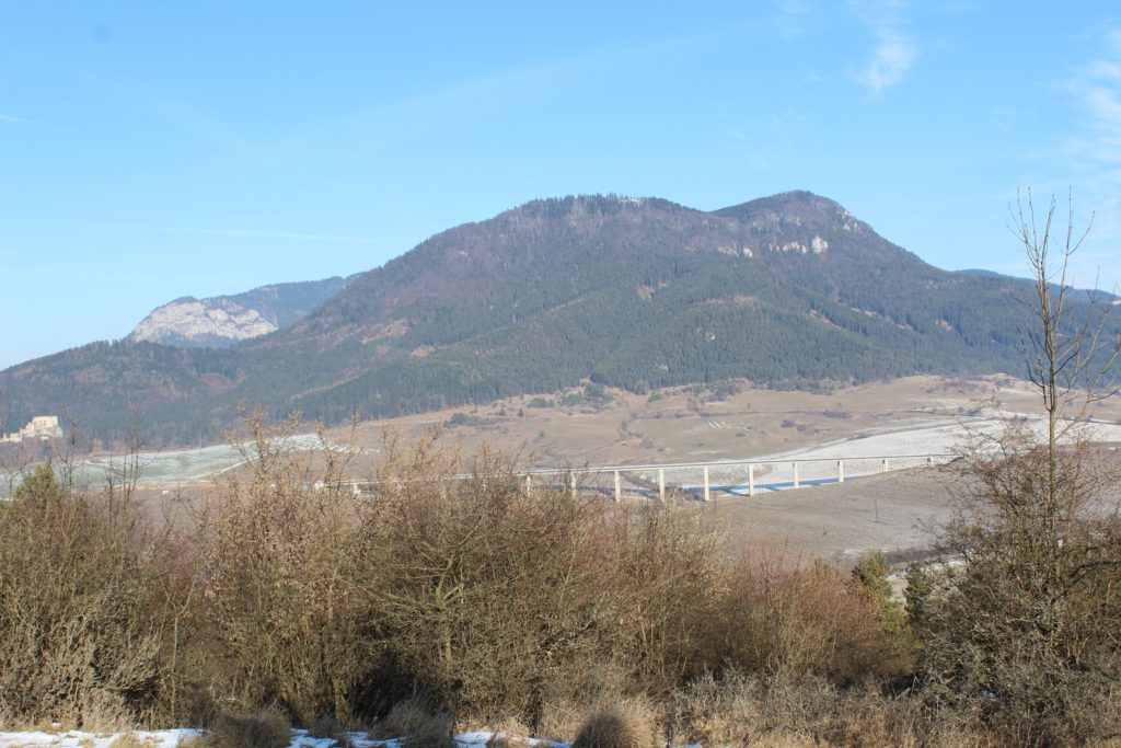
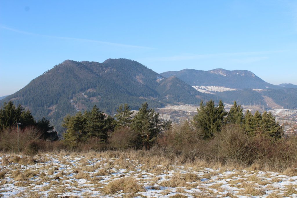
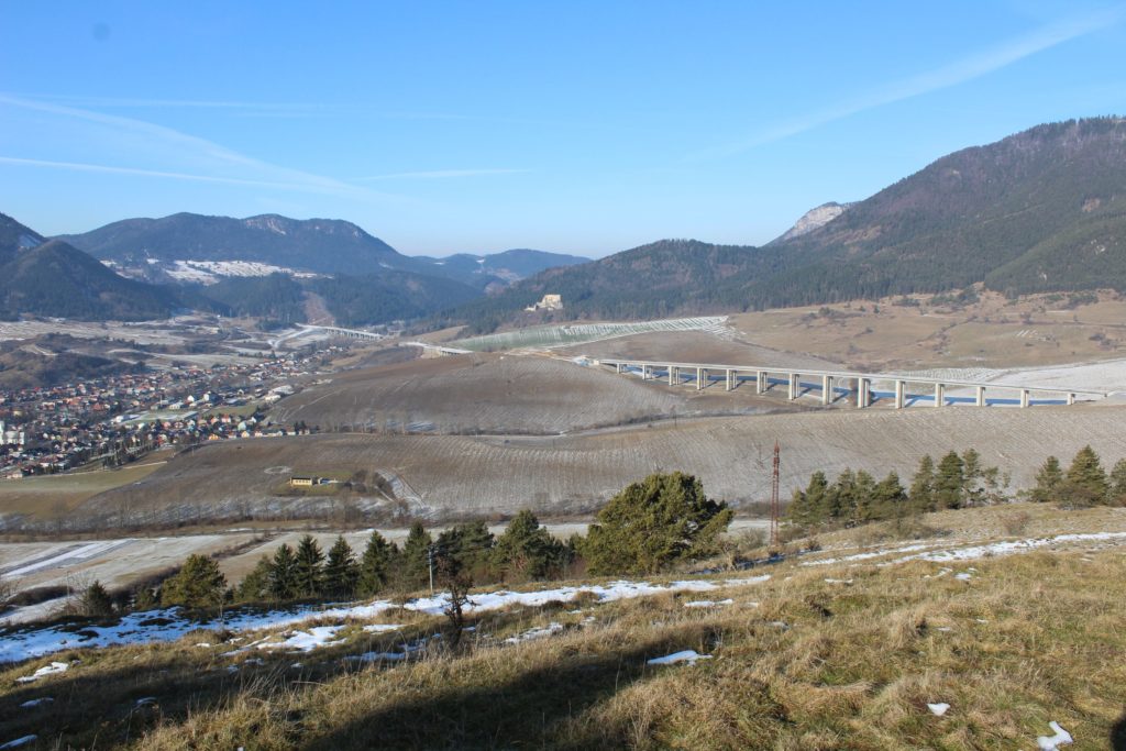
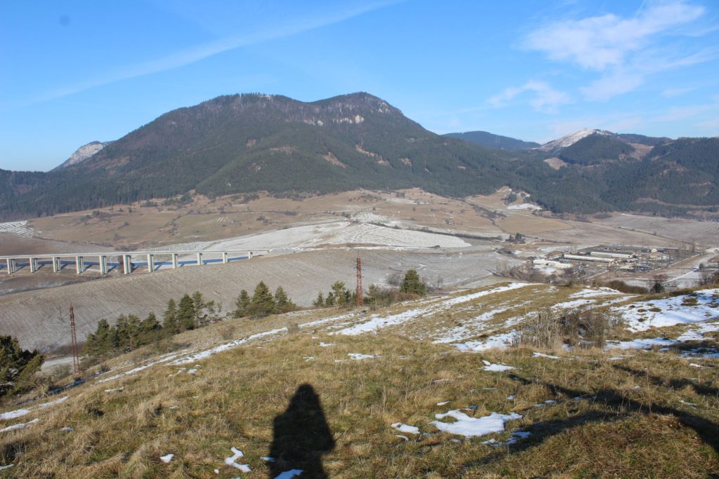
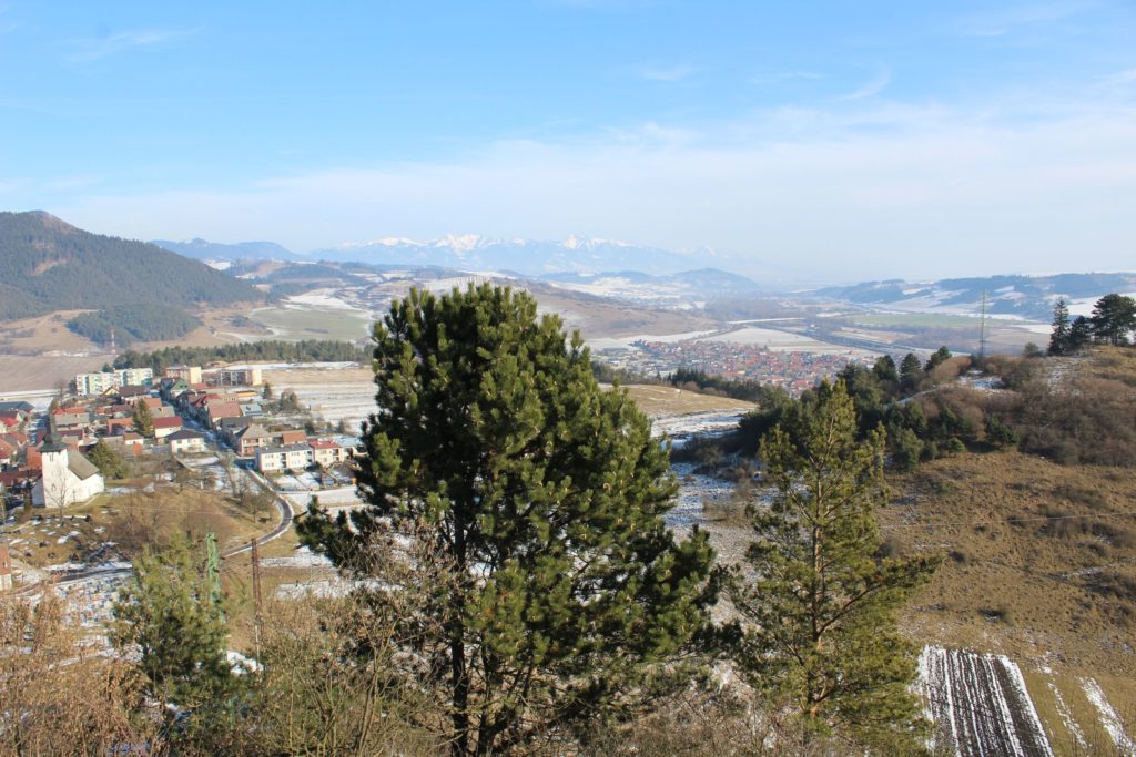
It is located north-east of the centre of Ružomberok. It is a part of the Choc Mountains. It is 657 m.a.s.l. high. It lies 1 km away from the centre of Ružomberok (as the crow flies). On the south side, the peak is covered with trees, and on the north side, it has meadows as well as trees in some areas. It offers a view of the north and partially of the west and the east. It is visible from the Liptov Basin.
It is accessible via unmarked trails and a field road from the centre of Ružomberok, Likavka, Martinček and Lisková.
The easiest way to the peak is from the town of Likavka, along the field road running from “Československej armády” Street, from the cross, which will lead us in between the houses and up to the peak.
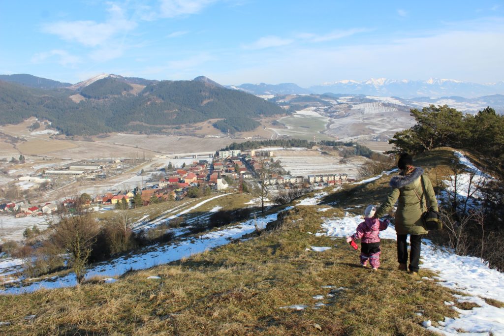
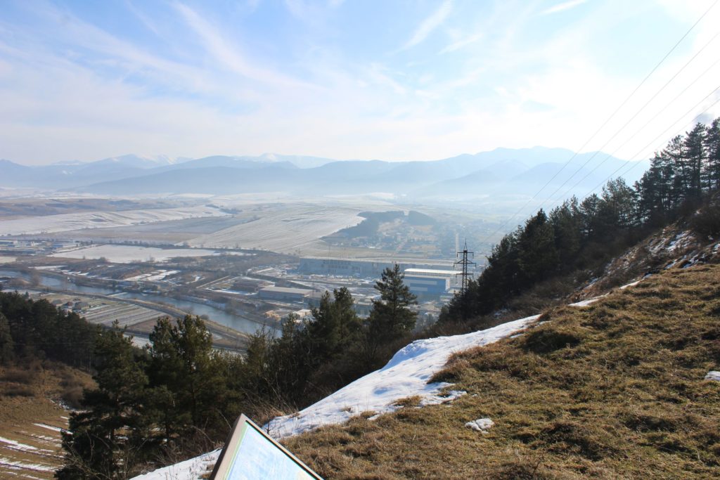
From the peak (the west peak), you can see mainly the town of Likavka, the town of Ružomberok and the Choc Mountains. From the east peak in the massive of Mních and the viewpoint, which is situated less than a kilometre away, you can see the town of Martinček, the Choc Mountains, the Liptov Basin and a part of the West Tatras and the Low Tatras.
Notes:
– Hiking trails are open all year round.
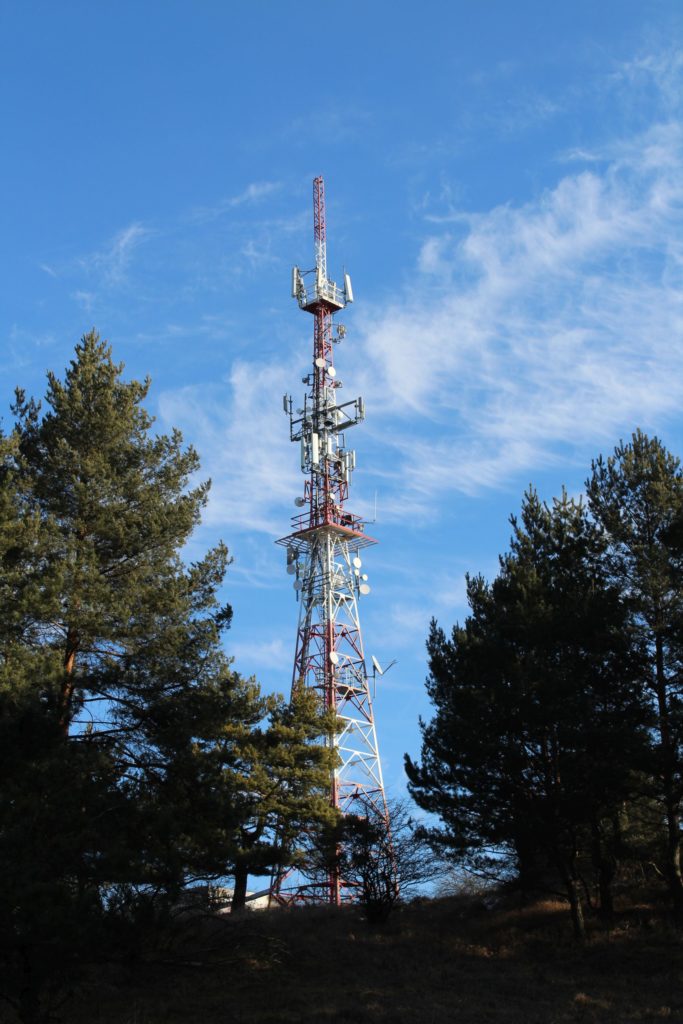
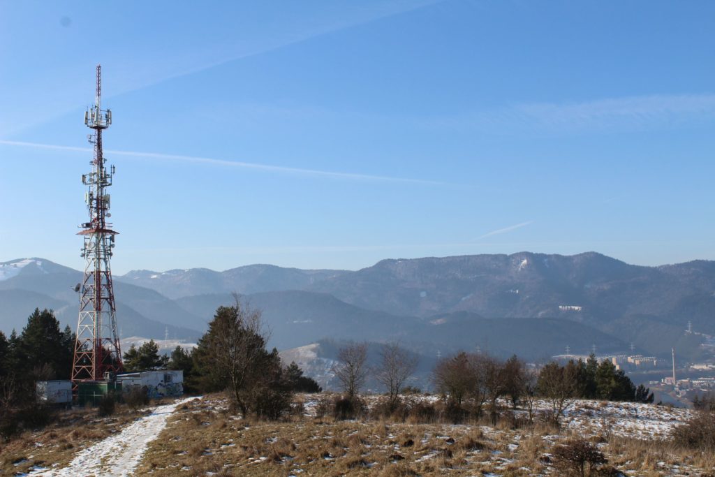
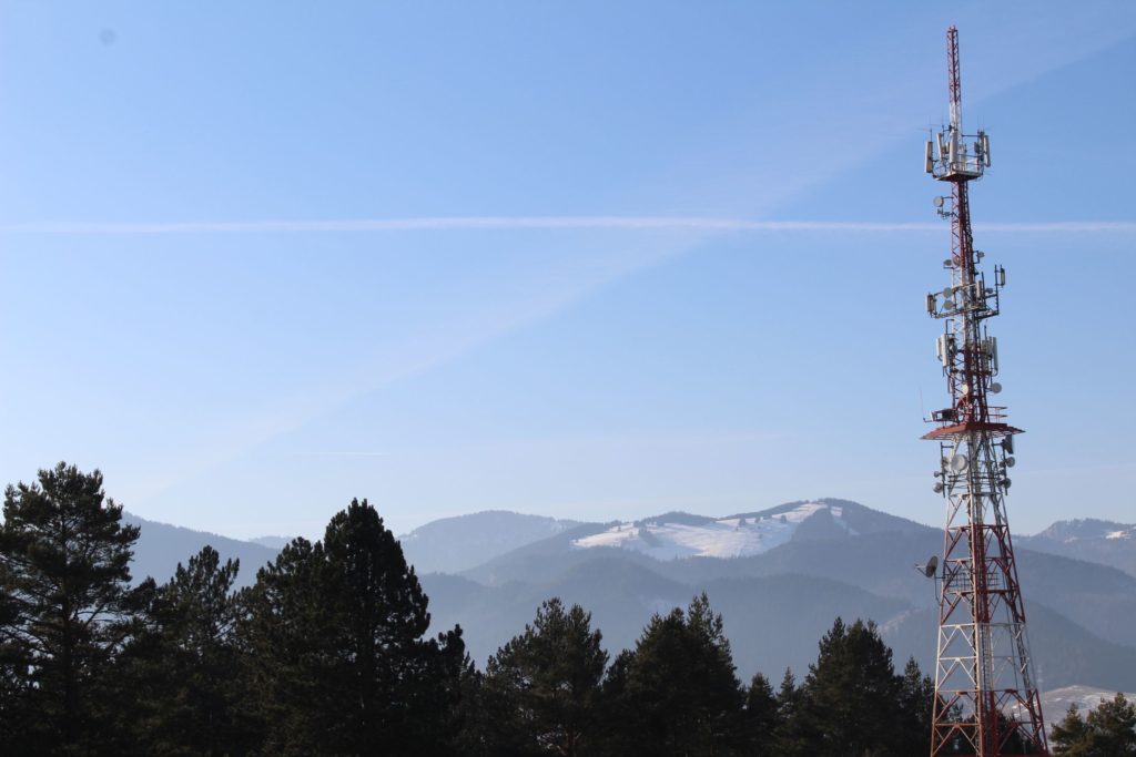
– At the west peak, there is a transmitter visible from a wide area.
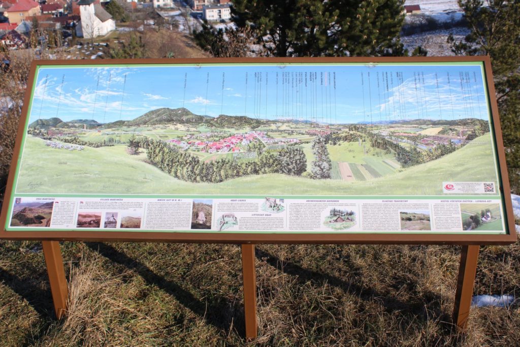
– Below the east peak, there is a sitting area and a panorama display including description.
– The hiking tour from Ružomberok takes approximately 1 hour.
– The hiking tour from Likavka takes approximately 40 minutes.
– Transition between the east peak and the west peak takes approximately 25 minutes.
– The hiking tour from Martinček to the east peak takes approximately 20 minutes.
– The hiking tour from Martinček to the viewpoint with a sitting area takes approximately 10 minutes.
– Traditionally, there is a hiking tour in costumes during Carnival Season.
– In the past, there used to be a hillfort at the top.
– Based on a legend, there used to be a Templar monastery at the top.
- Vlkolínec
- Nature
- Natural Attractions
- Protected Areas
- Peaks and Vistas
- Peak Veľký Choč (Great Choc)
- Peak Predný Čebrať
- Peak Rakytov
- Peak Salatín
- Peak Malinné
- Peak Ostredok
- Peak Veľká Chochuľa (Great Chochula)
- Peak Sidorovo
- Viewpoint Predný Choč (meadow)
- Peak Malý Salatín (Small Salatin)
- Peak Ploská
- Peak Zvolen
- Peak Krížna
- Peak Prašivá
- Peak Malý Zvolen (Small Zvolen)
- Peak Mních (Monk)
- Peak Malá Smrekovica (Small Smrekovica)
- Peak Kopa
- Peak Smrekovica
- Viewpoint “Štyri Chotáre” below peak Hrádok
- Peak Šiprúň
- Peak Košarisko
- Peak Malá Chochuľa
- Viewpoint below Skalka
- Viewpoint at the notch below Malý Salatín
- Peak Končitá
- Springs
- Well below Hrdoš, Švošov
- Well Malý Jarok, Černová
- Well Kalisko, Černová
- Well Dobrá Voda Spod Borovej, Ludrovská Valley
- Well below Sliačska Magura, Liptovské Sliače – Stredný
- Well in the Jastrabia Valley, Lúčky
- Well on the Žimerový creek, Lúčky
- Well in the valley of Uhlisko, Ružomberok – Vlkolínec
- Well in notch Hiadeľské Sedlo
- Well Vrchlúky, Ružomberok – Vlkolínec
- Well below Vrchlúky, Ružomberok – Vlkolínec
- Well Šimúnovo, Ružomberok
- Well near Hlivovo, Likavka
- Well by camping site Malá Turecká, Liptovské Revúce
- Well Vajdová, Liptovské Sliače – Vyšný
- Well “Srazy”, Ružomberok – Černová
- Well “Pri Krkavej Skale” (Near Krkava Rock), Ružomberok – Vlkolínec
- Well “Pod Žiarcom” (Below Žiarec), Valaská Dubová
- Well “Pod Záhradiskami” (Below Záhradiská), Ružomberok – Vlkolínec
- Well “Pod Spevákovou” (Below Speváková), Ružomberok – Vlkolínec
- Well “Pod Krkavou Skalou” (Below Krkava Rock), called „Za Lazy“, Ružomberok – Vlkolínec
- Well “Pod Dogerskými Skalami” (Below Dogerske Rocks), Ružomberok – Biely Potok
- Well “Hôrka”, Ružomberok – Vlkolínec
- Well “Dubovské Lúky” (Dubovske Meadows), Ružomberok – Hrboltová
- Spring below a chapel, Švošov
- Spring Jachym, Lisková
- Spring of the creek in Vlkolínec, Ružomberok – Vlkolínec
- Spring Medzi Hroble, Lisková
- Spring below Čierny Kameň – Koniarka, Liptovské Revúce
- Spring by notch Sedlo Ploskej, Ľubochňa
- Spring Kadlub, Kalameny
- Spring Malá Turecká, Liptovské Revúce
- Spring by Kuskova Vila, Likavka
- Spring below Sidorovo – above Opršalovo, Ružomberok
- Spring Hrabovská Cesta, Ružomberok
- Spring 1955-2015, Kalameny
- Spring Fountain in Korytnica, Liptovská Osada
- Spring Spa Jar Korytnica, Liptovská Osada
- Spring at Ležoviská by route E8
- Spring Posledná Voda, Liptovská Lúžna
- Spring at the turn to Korytnica, Liptovská Osada
- Spring Vyšné Javoriská by a cabin, Ružomberok – Podsuchá
- Spring “Za Túrnou”, Liptovská Osada
- Spring in the area of Dielec, Ružomberok
- Spring by the main ski run – bottom one, Ružomberok
- Spring by the main ski run – top one, Ružomberok
- Spring by the main ski run – middle one, Ružomberok
- Spring by a hunting cabin, Liptovské Sliače – Stredný
- Spring Vyšný Matejkov at Močidlo, below Smrekovica, Ružomberok
- Spring below Makovica, Liptovské Sliače – Stredný
- Conduit above Dvorisko, Ľubochňa
- Spring in the mouth of the Sliačska Valley, Liptovské Sliače – Stredný
- Spring by the Chapel of Saint Anton Paduansky, Lúčky
- Spring “Pod Tichým” (Below Tiché), Ružomberok – Podsuchá
- Spring “Pod Škutovkami” (Below Škutovky), Ružomberok – Podsuchá
- Spring “Pod Šetárkou” (Below Šetárka), Ružomberok – Nižné Matejkovo
- Spring “Pod Brdom” (Below Brdo), Ružomberok – Černová
- Spring at “Pod Orlíkom” Street, Ľubochňa
- Water outlet at Za Makovicou, above Hučiaky
- Spring in the Droždivá Valley, on the left above the SNU memorial, Ludrovská Valley
- Spring of the Matejkovský creek, Ružomberok
- Spring in Maďarovo, Ružomberok
- Spring of the Čutkovský creek, Černová
- Spring at Za Makovicou, above Hučiaky
- Spring Surová, Ludrovská Valley
- Spring Budkovica small, Černová
- Spring at a sheep farm below Končitá, Liptovské Revúce
- Spring below a rock at Kalisko, Černová
- Spring with a drinking basin, Fedorov, Stankovany
- Spring above Podšíp, the front one, Stankovany
- Spring above Podšíp, the back one, Stankovany
- Spring above Rybka, Stankovany
- Spring “Mosúrka”, Ružomberok – Biely Potok
- Spring Vyvieračka in the Jastrabia Valley, Lúčky
- Spring below the cemetery, Ružomberok
- Spring under the high voltage line at the Calvary, Ružomberok
- Spring Príkro, Ružomberok – Vlkolínec
- Spring “Hlboká”, Liptovská Osada
- Spring above Medzi Hroblami, Lisková
- Spring by spring Jachym, Lisková
- Drinking basin in the Švošov menagerie
- Spring above Nemecké Domky, Ružomberok
- Spring by Vyšné Lake between Čebrať hills, Likavka
- Spring below Čierny Kameň in Kratiny, Liptovské Revúce
- Spring below a well in valley Uhlisko, Ružomberok – Vlkolínec
- Spring by the lake, Kalameny
- Spring below Dielec, Kalameny
- Spring in the Švošov menagerie
- Spring by notch Sedlo pod Čiernym Kameňom, Ľubochňa
- Spring by the ski tow, Kalameny
- Spring Záblatné, Kalameny
- Rift from the water tower by the cemetery, Komjatná
- Spring below Havran, Švošov
- Spring below Bohúňovo, Liptovská Štiavnica
- Spring Hvozdec, Liptovské Sliače – Vyšný
- Spring above the trail above the complex in Smrekovica, Ružomberok
- Spring below Koniarka, Ružomberok – Vyšné Matejkovo
- Man-altered spring above Kramariská Farm, Likavka
- Spring “drinking basins” above Predný Hon, Martinček
- Spring by a cabin below Likava Castle, Likavka
- Spring Pod Kopanicami, Liptovské Sliače – Nižný
- Spring below Prostredný Grúň, Ružomberok – Vyšné Matejkovo
- Spring below Záklučie, Ružomberok – Vyšné Matejkovo
- Spring by the trail above the complex in Smrekovica, Ružomberok
- Spring Záhumnie, Liptovské Sliače – Nižný
- Spring Meškov 2, Ružomberok
- Spring Meškov above Giant’s Glasses, Ružomberok
- Spring Meškov, Ružomberok
- Spring above Giant’s Path, Ružomberok
- Spring above Giant’s Glasses, Ružomberok
- Spring above the Blizzard track, Ružomberok
- Spring below cabin village Šimúnovo, Ružomberok
- Spring below spring Meškov, Ružomberok
- Spring below the chair lift, Ružomberok
- Spring by the Šimúnovo Well, Ružomberok
- Spring Sliačanky 1, Liptovské Sliače – Stredný
- Spring Sliačanky 2, Liptovské Sliače – Stredný
- Spring in the Sliačska Valley 1, Liptovské Sliače – Stredný
- Spring in the Sliačska Valley 2, Liptovské Sliače – Stredný
- Spring in the Sliačska Valley 3, Liptovské Sliače – Stredný
- Spring in the Sliačska Valley 4, Liptovské Sliače – Stredný
- Spring below cabin Kiki, Ružomberok – Hrabovo
- Spring in Príkro, Ružomberok – Vlkolínec
- Spring above Kramariská Farm, Likavka
- Spring Nemcovô, Liptovská Osada
- Spring below Posledná Voda, Liptovská Lúžna
- Spring Stredný Úplaz, water tower, Liptovská Osada
- Spring Štítová, Liptovská Lúžna
- A small conduit below notch Hiadeľské Sedlo, Liptovská Osada
- Mud swamp on the way to Vrchlúky, Ružomberok – Vlkolínec
- Spring below the road to Vrchlúky, Ružomberok – Vlkolínec
- Spring “shaft” below the road to Vrchlúky, Ružomberok – Vlkolínec
- Spring in the canal of the Vlkolínec water line, Ružomberok – Vlkolínec
- Rift from the water tower above Borovka, Ružomberok – Vlkolínec
- Rift from the water tower below Vrchlúky, Ružomberok – Vlkolínec
- Mud swamp below Dielce, Ružomberok – Vlkolínec
- Spring above Krmelce, Ružomberok – Hrboltová
- Spring above a forest road, Ružomberok – Hrboltová
- Spring Sojkov below a sitting area, Ružomberok – Podsuchá
- Spring on a forest road, Ružomberok – Hrboltová
- Spring “žliebok” (small channel) below Radičiná, Ružomberok – Hrboltová
- Spring area Sojkov by a hunters‘ hide, Ružomberok – Podsuchá
- Spring on a trail below Šťukovka, Valaská Dubová
- Spring of the Žimerový creek, by a trail, Lúčky
- Spring of the Žimerový creek, Lúčky
- Conduit below Žiarec, Valaská Dubová
- Spring Budkovica, large, Černová
- Spring Droždivá, Ludrovská Valley
- Spring Dunaj (Danube), Ružomberok – Biely Potok
- Spring above the SNU memorial in the Ludrovská Valley
- Spring below rock Jánošíkova Skala, the bottom one, Ludrovská Valley
- Spring below rock Jánošíkova Skala, the top one, Ludrovská Valley
- Spring below Predný Šiprúň (Front Šiprúň) 1, Ružomberok
- Spring below Predný Šiprúň (Front Šiprúň) 2, Ružomberok
- Spring below notch Kalisko 2, Černová
- Spring below notch Kalisko, Černová
- Spring below notch Vyšné Šiprúnske Sedlo (Upper Šiprúň Notch) 1, Ružomberok
- Spring below notch Vyšné Šiprúnske Sedlo (Upper Šiprúň Notch) 2, Ružomberok
- Spring by the Matejkovský Creek, Ružomberok – Nižné Matejkovo
- Spring in the Droždivá Valley, the left one, Ludrovská Valley
- Spring in the Droždivá Valley, the right one, Ludrovská Valley
- Spring in the Droždivá Valley, on the right above the SNU memorial, Ludrovská Valley
- Conduit by a trail below Kalisko, Černová
- Spring above “Skalky” Street, Švošov
- Spring below rocks Kostoly, Komjatná
- Spring at S. Nemčeka Street, Likavka
- Spring below the road to the Likava Castle, Likavka
- Spring below the road above Predný Hon, Martinček
- Spring below Temný Svit, Martinček
- Spring by an animal feeder above the road to the Likava Castle, Likavka
- Spring behind Kramariská Farm, Likavka
- Spring above a well in valley Uhlisko, Ružomberok – Vlkolínec
- Spring in the woods above the Calvary 1, Ružomberok
- Spring in the woods above the Calvary 2, Ružomberok
- Spring in the woods above the Calvary 3, Ružomberok
- Spring above track Modrý Zamat (Blue Velvet), Ružomberok
- Spring below Haliny 1, Ružomberok
- Spring below Haliny 2, Ružomberok
- Spring area below the Farm below Sidorovo, Ružomberok
- Rift from the water source, Hrabovo, Ružomberok
- Spring by trail Medvedia Cesta (Bear’s Path), below the cableway, Ružomberok
- Spring by trail Medvedia Cesta (Bear’s Path), panel 3, Ružomberok
- Spring by trail Medvedia Cesta (Bear’s Path), panel 4, the bottom one, Ružomberok
- Spring by trail Medvedia Cesta (Bear’s Path), panel 4, the top one, Ružomberok
- Spring by trail Medvedia Cesta (Bear’s Path), panel 5, Ružomberok
- Mineral Springs
- Mineral spring “Žofia”, Liptovská Osada – Korytnica
- Mineral spring “Vyšňanský Medokýš”, Liptovská Štiavnica
- Mineral spring „Vrt STH – 2“, Stankovany
- Mineral spring „Vrt STH – 1A“, Stankovany
- Mineral spring “Vojtech”, Liptovská Osada – Korytnica
- Mineral spring “Valentína BJ – 101”, Lúčky
- Mineral spring “Sírny Medokýš”, Stankovany
- Mineral spring “Nižňanský Medokýš”, Liptovská Štiavnica
- Mineral spring “Medokýš” in Banské, Liptovská Lúžna
- Mineral spring “Medokýš Podsuchá”, Ružomberok – Nižné Matejkovo
- Mineral spring “Medokýš Hlinava”, Ružomberok – Podsuchá
- Mineral spring “Medokýš”, Ružomberok – Hrboltová
- Mineral spring “Medokýš”, Ludrová
- Mineral spring “Medokýš”, Liptovské Sliače
- Mineral Spring “Maťo”, Liptovská Lúžna
- Mineral spring “Kubo”, Liptovská Lúžna
- Mineral spring “Kadluba” in Banské, Liptovská Lúžna
- Mineral spring “Jozef”, Liptovská Osada – Korytnica
- Mineral spring “Čertovica” (Teplica), Liptovské Sliače
- Mineral spring “Černovský Medokýš”, Ružomberok – Černová
- Mineral spring “Antonín”, Liptovská Osada – Korytnica
- Mineral spring Medokýš below a wooded area, Stankovany
- Valleys
- Historical Monuments
- Likava Castle
- Castle of St. Žofia (Sophia)
- Andrej Hlinka Mausoleum
- Ružomberok Town Hall
- Ružomberok Stairs
- Liptov Castle
- Andrej Hlinka Community Centre
- Synagogue
- Marian Column
- Liptov Museum Building
- Memorial to the Martyrs in Černová
- Building of the Ľudovít Fulla Gallery
- Building of the former People’s Bank
- Municipal Library
- Railway Station in Ružomberok
- Former State Grammar School of German “Realschule”-Type
- Sculpture of Freedom
- The Tomb of Ľudovít Fulla
- Mitošiny Manor House in Bešeňová
- Manor House in Liptovská Teplá
- Manor House in Madočany
- Jubilee Garden near Liptovské Revúce
- Jubilee Linden Tree Garden in Likavka
- Kollar’s House in Ľubochňa
- Manor House in Turík
- Memorial Townsmen House of the Houdek Family
- Memorial Townsmen House of the Makovicky Family
- Defence Bunker near Liptovská Osada
- Memorial Site in Likavka with a Memorial to the Soldiers and the Partisans Killed during the Uprising
- Memorial to the Victims of the Slovak National Uprising in Korytnica
- Mother of the Partisans Memorial
- Memorial to the Victims of World Wars I and II in Lisková
- Birth House of Vavro Šrobár in Lisková
- Salt Office in Likavka
- Granaries in Hubová
- School at Dončová Street
- Hydro-power Station in Ľubochňa
- Military Park in Biely Potok
- Railway Stop Ružomberok – Rybárpole
- The Andrej Hlinka Square
- Place of the tragic event in Černová
- Sacral Monuments
- Churches
- Church of St. Andrew in Ružomberok
- Evangelical Church in Ružomberok
- Church of the Exaltation of the Holy Cross in Ružomberok
- All Saints Church in Ludrová – Kút
- Church of St. Simon and Jude in Liptovské Sliače
- Church of St. Martin in Martinček
- Church of St. Philip and Jacob in Liptovská Teplá
- Church of Virgin Mary of Rosary in Černová
- Church of St. Catherine of Alexandria in Hrboltová
- Church of the Assumption of Virgin Mary in Biely Potok
- Church of the Immaculate Conception of Virgin Mary in Liptovská Štiavnica
- Church of the Holy Family in Ružomberok – Rybárpole
- Church of St. George in Likavka
- Church of Cyril and Methodius in Ľubochňa
- Church of the Exaltation of the Holy Cross at Calvary in Ružomberok
- Church of the Exaltation of the Holy Cross in Lúčky
- Church of Two Hearts in Liptovské Sliače
- Hussite Church in Liptovská Osada
- Church of the Sacred Heart of Jesus in Stankovany
- Church of the Holy Trinity in Bešeňová
- Church of the Visitation of Virgin Mary in Turík
- Church of the Sacrifice of the Lord in Liptovské Revúce
- Church of the Exaltation of the Holy Cross in Hubová
- Church of Our Lady of Sorrows in Švošov
- Church of St. Cyril and Methodius in Ivachnová
- Church of Abbot St. Gál in Komjatná
- Church of St. John the Baptist in Liptovská Osada
- Church of St. Archangel Michael in Liptovský Michal
- Church of St. Peter and Paul in Kalameny
- Church of the Holy Family in Štiavnička
- All Saints Church in Ludrová
- Church of Transfiguration of the Lord in Lisková
- Church of St. Archangel Michael in Valaská Dubová
- Church of Virgin Mary near Liptovská Mara
- Church of the Holy Trinity in Liptovská Lúžna
- Chapels
- Chapel of Our Lady of Sorrows, Stankovany
- Chapel above the Calvary, Lisková
- Chapel at the cemetery, Liptovská Osada
- Chapel of Saint Anne, Studničná
- Chapel of Saint Gorazd in Smrekovica, Ružomberok
- Chapel of St. Peter and Paul in Ružomberok
- Chapel of Our Lady of Sorrows in Ružomberok
- Chapel of the Immaculate Conception of Virgin Mary in Ružomberok
- Hospital Chapel of Ružomberok, at “Generála Miloša Vesela” Street
- Vlkolínec Chapel, near Krkavá Skala (Krkava Rock)
- Chapel of St. Joseph in Hrboltová, under the castle
- Chapel of St. Anton in Nová Černová, “Pri Váhu” Street
- Chapel of Our Lady of Sorrows in Hrboltová, Hruštie
- Chapel of Ružomberok, “Tatranská cesta 2” Street
- Chapel of Virgin Mary in Korytnica, Liptovská Lúžna
- Chapel DEO Lúčky, Lúčky – spa
- Chapel Liptovské Revúce, Vyšná Revúca
- Chapel of Biely Potok, in the Trlenská Valley, Jesuit Convalescent Home
- Chapel of St. Anton Paduansky in Lúčky, Lúčky – spa
- Chapel of St. Joseph in Lúčky, Lúčky – spa
- Chapel of Liptovské Sliače – Vyšný, “Na Bežan” Street
- Chapel of Liptovské Sliače – Vyšný, “Bronislavy Kubánkovej” Street
- Chapel of Liptovské Sliače – Vyšný, “Čertovica” Notch
- Chapel of Liptovské Sliače – Vyšný, below the woods above “Tichá” Street
- Chapel of Liptovské Sliače – Stredný, mouth of the Sliačska Valley
- Chapel of Liptovské Sliače – Stredný, above Medokýš
- Chapel of Liptovská Štiavnica, in “Pri božej muke”
- Chapel of Likavka, at the intersection of J. Hollého – Pod Hradom
- Chapel by the Church of St. Simon and Jude in Liptovské Sliače – Stredný
- Chapel by the Church of Two Hearts in Liptovské Sliače – Vyšný
- Chapel by the Church of St. Cyril and Methodius in Ľubochňa
- Chapel of the Sacred Heart of Jesus in Liptovská Štiavnica
- Chapel of Lúčky, at the intersection of Slobody – Cintorínska
- Chapel of Ľubochňa, “Bahurina” Street
- Chapel of Our Lady of the Snows, Vlkolínec
- Chapel of Liptovské Sliače – Nižný, by the cemetery
- Chapel of Ružomberok, at the intersection of Bottova – Jána Jančeka
- Chapel of Liptovské Sliače – Stredný, at the intersection of Školská – K Medokýšu
- Chapel of Ružomberok, “Žilinská cesta” Street
- Chapel of Liptovské Sliače – Nižný, above the entryway to the town
- Chapel of St. Andrew in Korytnica
- Chapel of Saint Ján Nepomucký near Liptovská Štiavnica
- Chapel of Virgin Mary of Rosary in Magurka
- Chapel of Saint Ján Nepomucký in Ivachnová
- Chapel Komjatná, Hôrka
- Chapel Biela Púť, Ludrová
- Chapel DIX. MAT. V. 26, Ludrová
- Chapel of Our Lady of Sorrows at Paračka in Likavka
- Chapel of St. Hubert below Čebrať Hill in Likavka
- Chapel by cabin Májekova Chata, Ružomberok
- Chapel by the road to Šturec, Liptovské Revúce – Vyšná Revúca
- Chapel at Krstá Hora, Černová
- Chapel in Prieseka, Studničná
- Chapel below rock Sivá Skala, Komjatná
- Chapel Švošov, above a spring
- Chapel in the Komjatnianska Valley, Komjatná
- Lourdes Chapel by the Church of St. Archangel Michael, Valaská Dubová
- Chapel “Cave of Virgin Mary of Lourdes”, Likavka
- Chapel Likavka, “S. Nemčeka” Street
- Belfries
- Calvaries
- Crosses
- Cross by the soccer field, Stankovany
- Cross at Zadný Šíp, Stankovany
- Cross in Podšíp, Stankovany
- Cross at the end of Calvary, Lisková
- Cross at the cemetery, Martinček
- Cross Hrabovo, Ružomberok
- Cross Fedorov, Stankovany
- Mission cross by the church, Martinček
- Mission cross by the church, Stankovany
- Main cross at the cemetery, Liptovské Sliače – Nižný
- Main cross at the cemetery, Vlkolínec
- Cross in front of the fortification wall of the church, Liptovské Sliače – Stredný
- Cross Polianka, Liptovská Osada
- Cross above the cemetery, Liptovská Osada
- Cross at the cemetery, Vlkolínec
- Cross at the cemetery, Liptovské Sliače – Stredný
- Cross at the cemetery, Liptovské Sliače – Nižný
- Cross at the cemetery, Liptovská Osada
- Cross “Kaplnka” near Bešeňová
- Mission cross by the church, Vlkolínec
- Mission cross by the church, Liptovské Sliače – Stredný
- Mission cross by the church, Liptovská Osada
- Mission cross at the cemetery, Vlkolínec
- Cross in the fortification wall of the church, Liptovské Sliače – Stredný
- Cross Turík, Vlčia Jama
- Cross Likavka, by chapel “Cave of Virgin Mary of Lourdes”
- Cross Likavka, in front of Kramariská
- Mission cross by the church, Valaská Dubová
- Cross behind the church, Komjatná
- Cross Švošov, Staničná
- Cross Švošov, Nad Brehmi
- Cross Sedem Kostolov, Studničná
- Cross by the church in Studničná
- Cross by the Chapel of Saint Anne, Studničná
- Cross above Studničná
- Concrete cross Švošov, Staničná
- Cross Martinček, below Hradiská
- Cross in the Ludrovská Valley
- Cross at Zvolen
- Cross at Nová Hoľa
- Cross Černová, Repiská
- Cross Černová, by a way of the cross
- Cross Černová, Krstá Hora
- Small cross Černová, Krstá Hora
- Cross at Radičiná, Hrboltová
- Cross Černová, Badínka
- Cross of the gratitude of the healed 1869 in Korytnica, Liptovská Osada
- Cross in notch Hiadeľské Sedlo
- Cross Veľký Šturec, Liptovské Revúce – Vyšná Revúca
- Cross in front of the Turícka Valley, Turík
- Cross Črtľaž, Liptovské Revúce – Vyšná Revúca
- Cross Liptovské Sliače, above Sliačska Magura
- Cross Likavka, below Úboč Street
- Cross Likavka, Paračka
- Cross Likavka, above S. Nemčeka Street
- Cross Likavka, mine Drndošovo
- Cross Kalameny, Medokýš
- Cross Žabovo, Martinček
- Cross Komjatná, Hrádok
- Cross Komjatná, Hôrka
- Cross of God’s Torment Komjatná, Kriváň
- Cross of Valaská Dubová, “Brestová” Notch
- Cross in “Hrboltová” Forest Park
- Cross of Ružomberok, “Jelence” Street
- Cross of Ružomberok, below “Gejdák”
- Cross by the mill in Hrboltová
- Cross of Nová Černová, “Pri Váhu” Street
- Cross in Chlmky, Hrboltová
- Cross on the Work of Hrboltová, under the castle
- Cross of Ľubochňa, “Bahurina” Street
- Cross of Liptovské Sliače – Vyšný, “Stupy” Street
- Cross of Liptovské Sliače – Vyšný, Skálie
- Cross of Liptovské Sliače – Nižný, Hrádok
- Cross of Liptovská Štiavnica, Lúžok
- Cross of Likavka, “S. Nemčeka” Street
- Cross of John Paul II. in Valaská Dubová
- Cross of Hrboltová, Roveň
- Cross of Černová, Zrázy
- Cross of Černová, “Pri Váhu” Street
- Cross of Černová, in “Opaliny” by “Salaš Krajinka”
- Cross of Černová, Lanoviská
- Cross of Biely Potok, in the Trlenská Valley, Jesuit Convalescent Home
- Cross of Nová Černová, complex “U Dobrého Pastiera”
- Cross of Liptovské Sliače – Nižný, at the intersection of Hlavná – Na Majeri
- Cross of Nová Černová, Pod Milkov
- Cross of Liptovské Sliače – Stredný, Pažite
- Cross of Likavka, “Československej armády” Street
- Cross of Nová Černová, at the intersection of Čutkovská – Žilinská cesta
- Cross of Liptovské Sliače – Nižný, at the intersection of Hlavná – Záhumnie
- Cross of Liptovské Sliače – Stredný, by the cemetery
- Cross of Liptovské Sliače – Nižný, “Jarná” Street
- Cross of Martinček, entryway to the town
- Small cross Biely Potok, Kút
- Small cross Liptovská Lúžna, Jašicova Valley
- Small cross by the church, Liptovské Sliače – Stredný
- Stations
- Station above Podšíp, Stankovany
- Statue of St. Ján Nepomucký, Stankovany
- Station at the cemetery, Vlkolínec
- Station “south gate of the fortification wall of the church”, Liptovské Sliače – Stredný
- Station “new west entrance to the church”, Liptovské Sliače – Stredný
- Station Biely Potok, Kratiny
- Station “Cyril and Methodius” outside of the cemetery, Komjatná
- Station below rock Sivá Skala, Studničná
- Station in front of Komjatnianska Valley, Komjatná
- Station by a farmstead, Studničná
- Station in a shepherd’s hut below a rocky cliff, Studničná
- Station in the Komjatnianska Valley, Komjatná
- Station in a fence, Studničná
- Station in the Sliačska Valley by a cabin, Liptovské Sliače – Stredný
- Station Vidovô, Liptovské Sliače
- Station in a notch below Chopec, Liptovská Štiavnica
- Station near the end of the Sliačska Valley, Liptovské Sliače – Stredný
- Station “Heavenly Mother” below Makovica, Liptovské Sliače – Stredný
- Station Liptovské Sliače, by a well below Sliačska Magura
- Station Liptovské Sliače, above Sliačska Magura
- Station in the Jastrabia Valley, Lúčky
- Station Črtľaže, Liptovské Revúce – Vyšná Revúca
- Station Valaská Dubová, in front of the way of the cross
- Station by the road to Šturec, Liptovské Revúce – Vyšná Revúca
- Station Biely Potok, by Vlčí Dvor
- Lourdes Cave of Biely Potok, in the Trlenská Valley, Jesuit Convalescent Home
- Station in Vlkolínec, near “Krkavá” Rock
- Station in Valaská Dubová, by the way of the cross
- Station in Valaská Dubová, central square
- Station in Ľubochňa, “Pod Orlíkom” Street
- Station of Ľubochňa, Statue at “Pod Orlíkom” Street
- Station of Liptovské Sliače – Stredný, below the woods above “Horná Roveň” Street
- Station of Hrboltová, granary
- Station of Biely Potok, by the bridge
- Cemeteries
- Other (sacral monuments)
- Churches
- Museums and Galleries
- Sheep Farms and Shepherd’s Huts

